

Town/Region Profiles of Moe and Surrounding Areas
Churchill

Churchill is a small town located in Gippsland in the Latrobe Valley. Churchill is 160 kilometres east of the Melbourne Central Business district. During the 2016 national census there were 4,568 residents recorded. The town was named in honour of former British Prime Minister Sir Winston Churchill.
View More on Churchill
Erica

Erica is located approximately 105 kilometres east of Melbourne. The main road is the Moe-Rawson Road which runs through the town centre. There are about 320 residents that occupy residential and rural properties. Local tourism destinations include Mt Baw Baw, Walhalla Goldfields, Thomson Dam and Mt St Gwinear.
View More on Erica
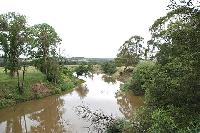
Hernes Oak
Location: 1.5 km south of Yallourn, near Haunted Hills and only minutes from Moe/Newborugh. Named: After Herne’s ghost which appeared by an oak tree and terrified cattle in The Merry Wives of Windsor. (Blake) A semi rural are located between Moe and Morwell with easy access to the Princes Fwy. Mostly small acreage properties are spread through some larger broad acre farms throughout the district.…
View More on Hernes oak
Hill End
Hill End, Victoria From Wikipedia, the free encyclopedia Population: 448[1] Postcode: 3825 Location: 95 km (59 mi) SE of Melbourne 60 km (37 mi) SE of Belgrave 26 km (16 mi) NW of Moe 25 km (16 mi) N of Trafalgar LGA: Shire of Baw Baw State electorate: Narracan Federal Division: McMillan Hill End is a town in the West Gippsland region of Victoria, Australia. The town is in the Shire of Baw Baw Local government area, 104 kilometres (65 mi) east of the state capital, Melbourne.…
View More on Hill End
Moe
Moe Real Estate, Victoria.
Want to know more about Moe? Want to know the price of a house or unit in Moe? Or, perhaps you have a block of land you want to be appraised. As of February 27, 2020, the median price of a house in Moe was $210,000. A median-priced unit was $150,000. The 12-month capital growth is at 5.13% for houses and 15.57% for units.
View More on Moe
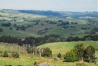
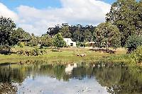
Moe South
The semi-rural to rural district of Moe South features meandering hills rolling toward the more southern districts of Coalville & Narracan, to the east at Hernes Oak and to the west Trafalgar South and Thorpdale. The centrepiece of this area is the winding Narracan Creek that flows through the Narracan Valley down through Moe and into the Latrobe River on the northern side of town. Often promoted as the premiere semi rural area of the Latrobe Valley, property values in the area are often comparable…
View More on Moe South
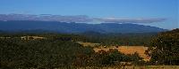
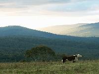
Mountain Rivers Region
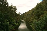
WALHALLA & MOUNTAIN RIVERS A great place to come and play HOME Food & Drink Accommodation Historic Attractions Services & Retail Maps Walhalla Vinter Ljusfest 1 to 26 August, 2012. The Valley of the Gods shines in August with special lighting, moving images and sound. See more here >> Mountain River Region All of the our great activities of our region are on offer. Ride the train, tour the mine, take a 4WD adventure or simply relax and enjoy. The Walhalla & Mountain Rivers region…
View More on Moutain Rivers Region
Newborough

Newborough Real Estate, Victoria.
From Wikipedia, the free encyclopedia Population: 6584 (2006)[1] Postcode: 3825 Location: 137 km (85 mi) E of Melbourne 19 km (12 mi) NW of Morwell 4 km (2 mi) E of Moe cbd LGA: City of Latrobe State electorate: Narracan Federal Division: McMillan Newborough is a town in the Latrobe Valley in Victoria, Australia which shares a border to its west, mostly along the Narracan Creek, with the town of Moe. It can be…
View More on Newborough
Rawson
Rawson, Victoria From Wikipedia, the free encyclopedia Population: 279 (2006)[1] Postcode: 3825 Coordinates: 37.9574°S 146.401°ECoordinates: 37.9574°S 146.401°E Location: 171 km (106 mi) E of Melbourne 37 km (23 mi) N of Moe LGA: Shire of Baw Baw State electorate: Narracan Federal Division: McMillan Rawson is a town in Victoria, Australia, located on Tyers – Thomson Valley Road, in the Shire of Baw Baw. The town was established for workers involved…
View More on Rawson
Tanjil South
Tanjil South – Willow Grove & District is a predominantly rural area, with several small villages. Tanjil South – Willow Grove & District is bounded by Yarra Ranges Shire and Mansfield Shire in the north, Wellington Shire in the east, Latrobe City and the localities of Trafalgar East, Trafalgar, Yarragon and Darnum in the south, and the localities of Nilma North, Buln Buln East, Neerim East, Neerim North, Noojee and Loch Valley in the west. This small area includes the localities of Aberfeldy,…
View More on Tanjil South
Trafalgar

Trafalgar is located in Gippsland West about 125 kilometres east of Melbourne. Its neighbouring towns include Trafalgar east and Yarragon. The population is approximately 3000. There are an even amount of families and singles residing in Trafalgar with an average age between 40 and 59. Home ownership accounts for 36% of the population with a further 40% in the process of purchasing.
View More on Trafalgar
Walhalla
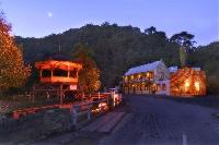
Walhalla, Victoria From Wikipedia, the free encyclopedia Not to be confused with Whyalla Population: 9 Postcode: 3825 Elevation: 360 m (1,181 ft) Location: 182 km (113 mi) E of Melbourne 49 km (30 mi) NE of Moe LGA: Shire of Baw Baw State electorate: Narracan Federal Division: McMillan Walhalla is a small town in Victoria, Australia, founded as a gold-mining community in early 1863 and at its peak home to around 2,500 residents. Today, the town…
View More on Walhalla
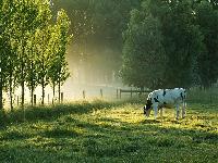
Westbury
Westbury, is 116 kms East of Melbourne and 8 kms North of Moe. Predominantly a farming district with the main industry being both dairy farming and beef cattle farming. Located only minutes from the main facilities in Moe, Westbury residents enjoy the priveledge of rural living with in town conveniences only a short drive away.…
View More on Westbury
Willow Grove
Willow Grove, Victoria From Wikipedia, the free encyclopedia Jump to: navigation, search Population: 221[1] Postcode: 3825 Elevation: 161 m (528 ft) Location: 142 km (88 mi) E of Melbourne 19 km (12 mi) NE of Moe 12 km (7 mi) NE of Tanjil South LGA: Shire of Baw Baw State electorate:Narracan Federal Division: McMillan Localities around Willow Grove: Tanjil Bren Hill End Willow Grove Tanjil South Willow Grove is a village and rural farming community north…
View More on Willow Grove
Yallourn North
Yallourn North, Victoria From Wikipedia, the free encyclopedia Population: 1448 (2006)[1] Postcode: 3825 Location: 152 km (94 mi) E of Melbourne 18 km (11 mi) NE of Moe 15 km (9 mi) N of Morwell LGA: City of Latrobe State electorate: Morwell Federal Division: McMillan Localities around Yallourn North: Moe Moondarra Tyers Tanjil South/East Traralgon Hernes Oak Morwell Yallourn North is a small country town in the City of Latrobe, Victoria, Australia. It is approximately…
View More on Yallourn North